The Wetland on Your Property Is Not the Problem. When You Find It Is.
Most developers who encounter a wetland problem on a project did not discover it on the day they closed on the land. They discovered it six months later, after a site plan was drawn, after a contractor was selected, and in some cases after a financing commitment was structured around a project density that the property could never actually support. By that point, the wetland is not an environmental constraint. It is a financial crisis.
The property still cost what it cost. The lender still expects what they were told to expect. The proforma still shows the revenue the developer underwrote. But a portion of the land that was assumed to be buildable is not, and neither is a buffer around it. The density drops. The revenue per acre drops with it. And the price paid for the land, which was underwritten against a set of assumptions that turned out to be wrong, is now locked in.
This is not a rare situation. We have worked with developers and owners during due diligence specifically to prevent it. The conversation we have with clients before they acquire land is fundamentally different from the one most civil engineers have after acquisition, and that difference is what this article is about.
What Changed in 2025 and Why the Old Assumptions No Longer Hold
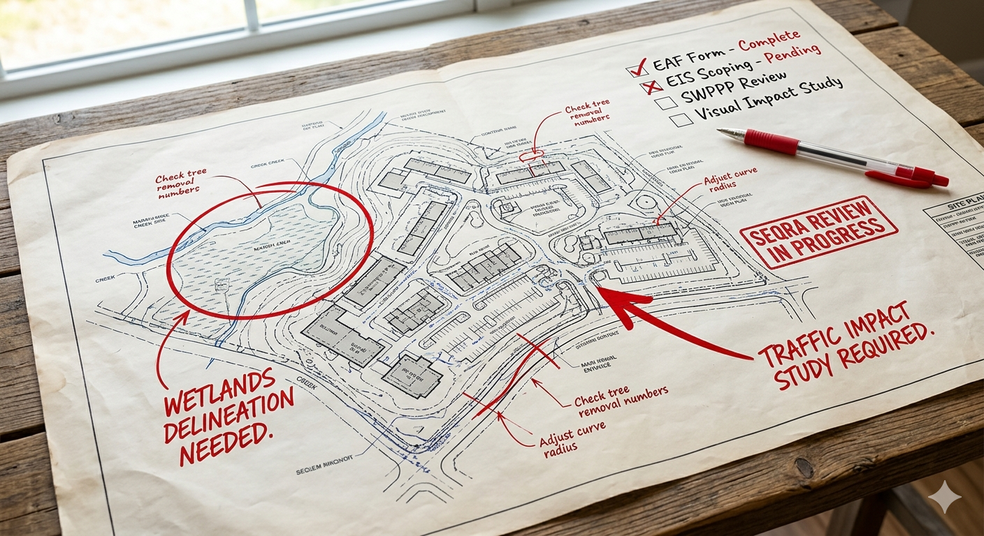
New York State fundamentally amended the Freshwater Wetlands Act effective January 2025. The most consequential change for developers is the reduction of the jurisdictional size threshold. The long-standing 12.4-acre minimum, which previously exempted many mid-sized parcels from state regulation entirely, has been lowered to 7.4 acres. That is not a minor adjustment. It brings a substantial number of sites that were considered clean under the prior framework into regulated territory. And by 2028, the phase-in continues further: wetlands of “unusual importance” will fall under state oversight regardless of size, meaning even a fraction-of-an-acre wetland can trigger full regulatory review if the DEC determines it provides significant ecosystem services.
Equally significant is the shift from map-based to science-based jurisdiction. Under the prior framework, if a wetland was not on an official DEC map, it was generally not regulated by the state. That is no longer true. Jurisdiction is now self-executing, determined by field-verified criteria assessing hydrology, hydric soils, and hydrophytic vegetation. If the biology is present, the regulation applies, regardless of whether the feature appears on any official map. The implication for developers is direct: the absence of a DEC-mapped wetland on a property is no longer meaningful due diligence. It is a starting point at best.
The 100-foot adjacent area buffer remains the standard baseline, but the DEC now has broader authority to designate wetlands as having “unusual importance,” a classification that can be triggered by factors including flood storage capacity, rare species habitat, watershed position, or urban location. This designation gives the agency the ability to assert jurisdiction over smaller features that were previously invisible to state regulators and to apply heightened scrutiny to adjacent area determinations. A wetland that generates a standard 100-foot buffer under a routine review may generate a significantly larger one under an unusual importance designation.
The federal dimension has also become more complicated. The U.S. Army Corps of Engineers regulates wetlands under Section 404 of the Clean Water Act, and with the state’s expanded reach, more projects now carry concurrent state and federal review obligations. Because these two agencies use slightly different delineation methodologies and operate on entirely independent permitting timelines, a federal determination that no permit is required no longer guarantees a clear path at the state level. The sequencing risk of running dual reviews has increased materially under the new framework.
The 2025 changes did not simply add regulated wetlands to the landscape. They removed the shortcuts that allowed developers to assume a property was clean without field verification. The size threshold is lower. Jurisdiction is now self-executing. The "unusual importance" designation creates a wildcard that can affect even very small features. And DEC mapping has not kept pace with the expanded criteria, making it less reliable as a due diligence tool than it was before the amendments. The only answer that holds up is a field delineation conducted by a qualified professional, integrated with survey data, and assessed against the current regulatory standard.
Wetlands Directly Affect Your Revenue Model
This is the part of the wetland conversation that most environmental consultants do not have with their clients, because most environmental consultants are not also civil engineers and land surveyors who understand site development economics. The connection between wetland acreage and project revenue is direct, calculable, and consequential.
The logic runs as follows. A commercial or industrial development is underwritten against a density assumption: how many square feet of building, how many dwelling units, how many parking spaces, how many lots can this property support. That density assumption drives the revenue projection, which drives the project’s financial feasibility, which drives how much a developer can afford to pay for the land.
Wetlands reduce developable area in two ways. The wetland itself is almost never buildable. The adjacent area buffer around it, which is now more expansive and more variable than it was before 2025, is also typically unbuildable or carries significant design constraints. Together, those two zones can remove a substantial portion of a parcel’s assumed buildable area from the density calculation.
We have worked with developers during the due diligence phase of land acquisitions to produce exactly this kind of analysis: a field delineation integrated with survey data and preliminary site planning to produce an accurate net developable area calculation before the purchase contract closes. That number informs what the land is actually worth to the buyer, and in many cases it becomes a direct input into purchase price negotiations.
A seller who has priced land based on gross acreage, without accounting for regulated wetlands and buffers, is pricing land on an assumption. A buyer who arrives at the table with a delineation in hand, a survey overlay, and a net developable area calculation has objective data on their side. That is a meaningfully different negotiating position.
The delineation we perform during due diligence is not an environmental exercise. It is a financial tool. It tells our clients what they are actually buying before they commit to paying for what they assume they are buying.
What a Wetland Delineation Actually Involves
A wetland delineation is a field-based determination of where regulated wetland boundaries exist on a property. It is conducted by a qualified environmental professional using criteria established by both the Army Corps of Engineers and NYSDEC, which assess hydrology, hydric soils, and hydrophytic vegetation. The delineation is then surveyed into the base map so that the wetland boundary becomes a real design input rather than a general awareness.
That last step, the survey integration, is where most delineations either do their job or fall short. A delineation that produces a report and a set of flags in the ground but is never precisely located on a survey is useful for regulatory purposes but far less useful for design. When the delineation and the survey are performed by the same team with direct coordination, the wetland boundary becomes immediately actionable: it constrains the site plan, informs the grading strategy, drives the stormwater design, and shapes the density calculation. That is the version of this work that protects developers financially.
Where Projects Go Wrong and Why It Is Avoidable
The most expensive wetland problems on development projects share a common characteristic: they were discoverable before acquisition and were not discovered until after it. None of the following mistakes are unusual. All of them are preventable.
-
Relying on DEC mapping as a due diligence substitute. The NYSDEC wetland maps are a regulatory reference tool, not a field-accurate boundary. They are often outdated, frequently imprecise, and do not reflect the expanded criteria introduced in 2025. Developers who use the absence of a DEC-mapped wetland as confirmation that no regulated wetland exists are taking on unquantified risk. The map tells you where to look. It does not tell you what is there.
-
Engaging an environmental consultant who is disconnected from site design. A wetland delineation performed in isolation from the site planning process produces a report and a set of coordinates. A delineation performed in coordination with a civil engineer and land surveyor produces an accurate buildable envelope and a density calculation that can be used to underwrite a purchase price. These are not the same product, and one of them is far more valuable to a developer making an acquisition decision.
-
Underestimating adjacent area constraints. Developers who are aware of a wetland on a property often account for the wetland itself in their density calculations but not for the regulated adjacent area around it. The standard 100-foot buffer is the baseline, not the ceiling. The DEC's expanded authority under the 2025 framework to designate wetlands of "unusual importance" means buffer requirements can extend significantly further based on the wetland's functional characteristics. The buildable area loss from adjacent area constraints frequently exceeds the loss from the wetland boundary itself.
-
Treating the delineation as a post-acquisition task. The delineation belongs in due diligence, not in the design phase. Once a purchase contract closes, the buyer owns the problem. A delineation completed before closing can inform the purchase price, enable a renegotiation, or in some cases justify walking away from a deal that does not pencil at the density the site can actually support.
-
Failing to account for wetlands in the SEQRA analysis. Regulated wetlands are one of the most reliable triggers for expanded SEQRA review. A project that was expected to receive a negative declaration quickly can be pushed into a longer, more intensive review process when wetlands are present, particularly if the project involves impacts to regulated areas. That timeline shift has real carrying cost implications and belongs in the project pro forma from the start.
Delineation, Survey, and Site Design as One Coordinated Strategy
The way most development teams approach wetlands is sequential: the environmental consultant performs the delineation, hands the report to the civil engineer, who then tries to design around the constraints. That handoff creates delays, produces friction between disciplines, and almost always results in at least one round of redesign as the civil team works through implications the environmental team did not anticipate.
The way we approach it is different, because we have both disciplines in-house and because we think about wetland delineation as a planning exercise from the beginning, not an environmental compliance exercise. When the person flagging the wetland boundary is coordinating in real time with the person drawing the site plan and the person producing the survey base map, the constraint informs the design from its first iteration rather than forcing a revision of the second or third.
For developers in the due diligence phase, this integrated approach produces a specific and highly useful output: a net developable area analysis with a preliminary site plan overlaid on the actual, field-delineated, surveyed wetland boundary. That document tells you how many lots, how many square feet, how many units, or how much impervious cover the property can realistically support. It is the number your revenue model should be built on. And it is the number that should be on the table when you are negotiating what the land is worth.
We have worked with developers and commercial property buyers during the due diligence period to conduct delineations, integrate them with survey base maps, and produce preliminary density analyses that informed acquisition decisions. In several cases, that analysis supported a meaningful reduction in the purchase price negotiation. In others, it helped the buyer walk away from a property before closing that would not have supported the project they had in mind. In either outcome, the work paid for itself many times over.
The SEQRA dimension of this integrated approach also matters. When we have prepared the delineation, the survey, and the preliminary site design, we can anticipate how the planning board and reviewing agencies will react to the project’s relationship with the wetland long before the application is filed. We know what documentation they will want, what concerns they are likely to raise, and what design decisions will reduce scrutiny versus increase it. That knowledge shapes the project from concept, not from response.
Most teams discover constraints. We plan around them before they become problems. The delineation is not the end of the wetland conversation. It is the beginning of the design conversation.
What Developers and Property Owners Should Do Now
The 2025 regulatory changes have made early wetland due diligence more important than it has ever been in New York State. The following recommendations apply to any commercial or industrial developer evaluating a property, under letter of intent, or in the early stages of site planning.
Frequently Asked Questions
Know What You Are Buying Before You Buy It
Wetlands are no longer a secondary consideration in New York State site development. The 2025 regulatory changes have expanded both the universe of regulated wetlands and the discretion that reviewing agencies have in applying buffer requirements. Properties that were previously assumed to be clean are not always clean. Density calculations that were built on gross acreage assumptions are not always accurate. And acquisition prices that were negotiated without a field-verified buildable area analysis are not always justifiable.
The developers who navigate this environment successfully are the ones who treat due diligence as a financial exercise, not just a legal one. A field delineation integrated with survey data and preliminary site planning is not an overhead cost. It is the most reliable way to know what a piece of land is actually worth before you commit to paying for it.
If you are evaluating a property, under contract, or in the early stages of planning a commercial or industrial project in Western New York, we would welcome a conversation. We help clients understand what a site can support before they invest in the wrong direction, and we do it early enough in the process for that understanding to actually matter.
Early is the only time it helps.